- Home
- »
- Hardman Barlow Canyon Arlington
Hardman Barlow Canyon Arlington
Hardman Barlow Canyon Arlington
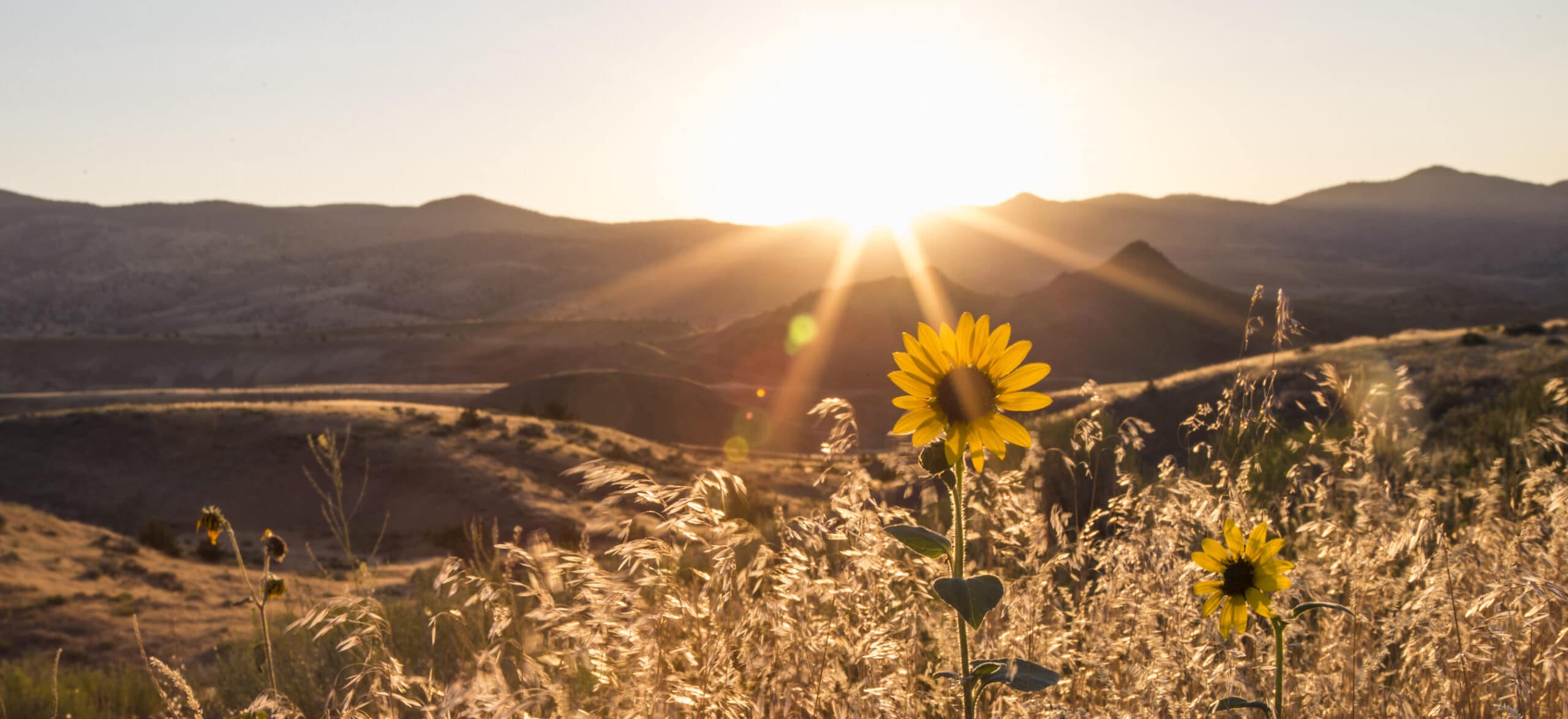
Get a little taste of life on the Oregon Trail as you wander north from the high desert to the mighty Columbia River on this route that follows part of an Oregon Trail alternate in its last half. The good news for you is that it’s downhill, and you have a much more maneuverable vehicle than the pioneers traveled with.
In the first stretch of riding on Hardman Ridge Road, the road turns primitive quickly for a mile or two, from being a traveled pathway to something that looks like it hasn’t been traversed in years.
Then you’ll see for yourself the odd demarcation of Hardman/Hale Ridge – the one side should be known as Hail Ridge (and once was), because it’s the line between where wheat can’t grow (south, on the Hale side) and where it can (north on the Hardman side). This is because of severe weather on one side, including… hail. For you it provides a divided view that’s both interesting and thought-provoking.
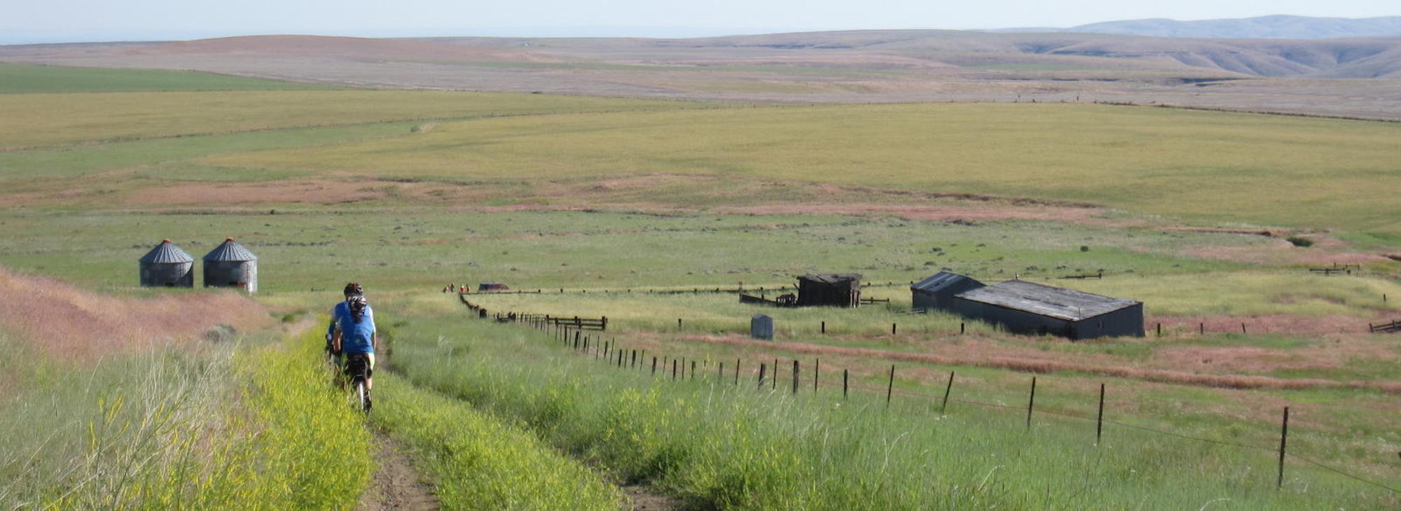
After you crest and start dropping, you’ll pass the old one-room Liberty School, with its empty windows staring out at postcard views of Mt. Hood. A long glide down Barlow Canyon Road will take you past weathered, abandoned homesteads that look like people just gathered a few things and moved on suddenly – which is exactly what happened in the 1940s. The progression of farmers and their families leaving went from high to low as the water table dried up. Today you can still see equipment left behind, curtains in windows… take a moment to ponder the hardscrabble lives those folks lived on this rangeland, and the frailty of rural existence.
But you may not choose to stop and think, because you’re having too much fun riding. By the time you reach Ione-Gooseberry Road, you’ll have rolled over 18 miles of uninterrupted gravel – some of it feeling smoother than a paved road as you fly along at upwards of 30 mph.
After a brief climb to a plateau, follow Cayuse Canyon down on the modern version of a trail that intersects the original Oregon Trail.
And here’s another piece of history. As you ride through the wide-open spaces, you’ll notice oddly out-of-place grain silos in the middle of nowhere. Here’s the story: After the Japanese bomber Pearl Harbor in World War II, the U.S. government wanted to protect its grain (food) from potential attack in high-population, easily accessed areas. So they built silos here where they wouldn’t be an attractive target.
Around Mile 30, as you ride along a ridge on – yes – Ridge Road, you’ll see the valley fall away dramatically to the east, as Rock Creek Canyon stretches seemingly forever west- and northward. You can get lost in the scale of a place like this.
Finally, after enjoying another 15 miles of gravel, you’ll descend gradually to the town of Arlington, squeezing through Alkali Canyon just before hitting civilization and the vast power of the Columbia River.
To finish off your experience, enjoy a refreshing swim at Earl Snell Park, and then head over to the town of Boardman to visit the SAGE (Sustainable Agriculture and Energy) Center, an interactive visitor center that offers various exhibits and events.
And feel like a bicycle pioneer.
Hardman Barlow Canyon Arlington
Contact Info
Heppner, OR


Oregon's Rugged Country
Wildhorse Resort & Casino
The Pacific Northwest’s highest paying casino, Wildhorse Resort & Casino is the only Class III Gaming floor this far East in [...]
46510 Wildhorse Blvd. Pendleton, OR
800-654-9453